


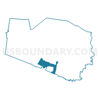
03-1 Thompson Station Baptist Church Voting District, Williamson County, Tennessee
About
Outline

Summary
| Unique Area Identifier | 670011 |
| Name | 03-1 Thompson Station Baptist Church Voting District |
| County | Williamson County |
| State | Tennessee |
| Area (square miles) | 14.46 |
| Land Area (square miles) | 14.46 |
| Water Area (square miles) | 0.00 |
| % of Land Area | 100.00 |
| % of Water Area | 0.00 |
| Latitude of the Internal Point | 35.79636730 |
| Longtitude of the Internal Point | -86.92663030 |
Maps


Graphs
Select a template below for downloading or customizing gragh for 03-1 Thompson Station Baptist Church Voting District, Williamson County, Tennessee


Neighbors
Neighoring Voting District (by Name) Neighboring Voting District on the Map
- 02-2 Grace Chapel Voting District, Williamson County, TN
- 02-3 Oak View Elementary Voting District, Williamson County, TN
- 03-2 Bethesda Recreation Center Voting District, Williamson County, TN
- 03-4 Heritage Elementary Voting District, Williamson County, TN
- 03-5 Longview Voting District, Williamson County, TN
- Spring Hill Voting District, Maury County, TN
Top 10 Neighboring County Subdivision (by Population) Neighboring County Subdivision on the Map
- District 3, Williamson County, TN (28,564)
- District 2, Williamson County, TN (16,634)
- District 11, Maury County, TN (12,480)
Top 10 Neighboring Place (by Population) Neighboring Place on the Map
Top 10 Neighboring Unified School District (by Population) Neighboring Unified School District on the Map
Top 10 Neighboring State Legislative District Lower Chamber (by Population) Neighboring State Legislative District Lower Chamber on the Map
Top 10 Neighboring State Legislative District Upper Chamber (by Population) Neighboring State Legislative District Upper Chamber on the Map
Top 10 Neighboring 111th Congressional District (by Population) Neighboring 111th Congressional District on the Map
Top 10 Neighboring Census Tract (by Population) Neighboring Census Tract on the Map
- Census Tract 512.02, Williamson County, TN (21,763)
- Census Tract 102.02, Maury County, TN (7,235)
- Census Tract 102.01, Maury County, TN (5,685)
- Census Tract 512.01, Williamson County, TN (5,682)
- Census Tract 511, Williamson County, TN (5,583)
- Census Tract 510.02, Williamson County, TN (5,516)
- Census Tract 509.09, Williamson County, TN (3,300)